
1 Giving Mountains Names
This article does not aim to unravel the meaning of the names of any particular peaks and mountains; this is not a work of etymology or nomenclature. My goal is instead to uncover some clues as to the motivation for and purpose of naming mountains. Why must mountains be given names at all? And why (this is my second question) do they have the specific names that are familiar to us today and facilitate unambiguous communication? How did our mountain names make it on to maps and thereby become sacrosanct? I am interested in the (often curious) history of mountain names and not in their linguistic origins.
My questions appear so trivial that historians of Alpine exploration have hardly even registered their existence. They appear trivial to us today because mountains everywhere received their names so long ago in a process that is also familiar to us from other contexts—as per Hans Blumenberg’s famous definition of the modern age as the epoch that finally found a name for everything.1 In the case of the mountain names, we can pin Blumenberg’s “modern age” down to a quite specific timespan: it was first in the nineteenth century that mountains, especially the highest peaks, received their names—apparently forever.
Indeed, naming goes back to the dawn of humanity. The Biblical myth of the first humans, as narrated in the second story of creation, depicts name-giving in a charming scene: God brings all the animals to the first human being “to see what he would name them; and whatever the man called each living creature, that was its name” (Gen. 2:19, NIV). Bestowing names was—and is not—a task for God, it seems, but for humans—what we might, in modern diction, call a matter of culture: “So the man gave names to all the livestock, the birds in the sky, and all the wild animals” (Gen. 2:20). This business of assigning names went on for a long time, of course, as we can well discern from the jittery activity of early Alpinists in the new field of mountain botany in the late eighteenth and early nineteenth century. Dozens, or indeed hundreds, of previously unheard, freshly devised names were found for and attached to newly discovered plants in accordance with Linnaean taxonomy. Rocks and minerals were given similar treatment, and why should the mountain peaks have been exempted? The more attention peaks attracted—as newly discovered individuals, so to speak—from all with an interest in the Alps, the more pressing the need to find appropriate names for them became.
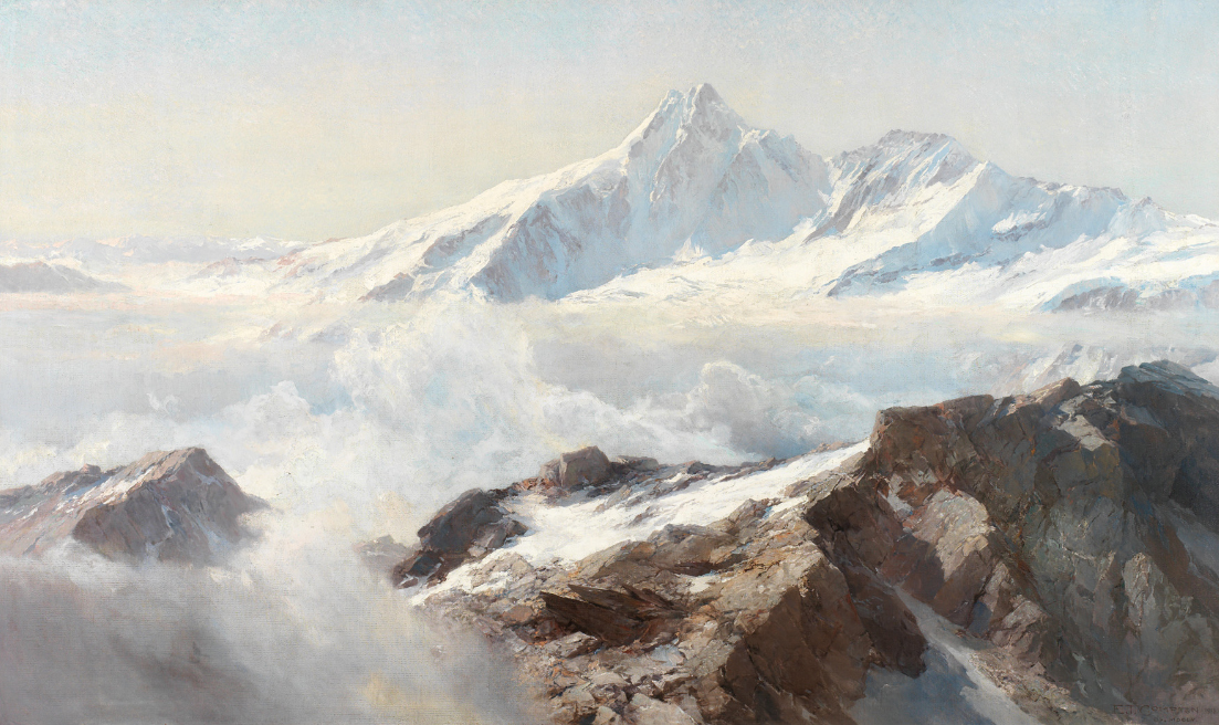
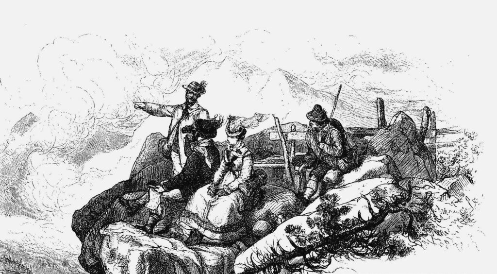
The problem that arises here (and may not be entirely obvious to people nowadays) is captured evocatively in two scenes in Johanna Spyri’s Heidi, and taking up this wildly popular yet oft-derided bestseller here affords me an opportunity to shed some light on my essay title, which may initially have appeared somewhat obscure. In the third chapter of Heidi: Her Years of Wandering and Learning (called “In the Pasture”), the girl—das Heidi in German, grammatically neutral rather than feminine—is spellbound, shocked even, by the alpenglow on the rock faces in the evening the first time she accompanies the goatherd Peter to the higher pasture above her grandfather’s alm: “Look, look! the highest peak is glowing. Oh, the beautiful fire!” Heidi asks for an explanation, but Peter says only that “It is always like that, but it is no fire,” and that it “comes of itself.” Heidi cannot take her eyes off the wondrously illuminated mountains and cries out excitedly: “just this minute it is all as red as roses. Look at the snow and those high, pointed rocks! What are they called?” Peter’s answer is characteristically taciturn: “Mountains have no names.”2 Before delving any further into the substance of this terse and initially rather peculiar-seeming answer, I will describe a second scene from later in this chapter that essentially mirrors this first one. Heidi directs the answer given by the goatherd Peter to her grandfather as a question: “But why have the mountains no names?” Her grandfather replies that they do have names and promises to tell her the name of a mountain if she can describe one to him so that he recognizes it.3 Heidi describes two mountains and her grandfather promptly tells her their names: Falkniss and Scesaplana4 (Illustration 1). So did the mountains “have names” after all? In this case, Spyri was a keen observer. The mountains the local population saw every day, the ones whose appearance was known and could be described, did have names. But the more distant mountains that were of interest to mountain travelers and Alpinists (the higher mountains, hidden from view by others in front of them) were mostly unknown (“Mountains have no names” as the goatherd Peter tells us!)—and this fact created an enormous problem for anyone trying to become oriented in the area.
2 Without Names, Orientation Is Impossible
One of the most thoughtful early mountain travelers, Hans Conrad Escher from Zurich (who we also know, not coincidentally, as a keen producer of unerring and meticulously labeled panoramic drawings5), pointed repeatedly to the importance of being able to “definitively name and label distant areas and mountains where one has never set foot” when orienting oneself in unfamiliar terrain and in the mountains.6 Escher highlighted in particular the problem of locations that were “hidden” from sight by perspective.7 He used the example of the Finsteraarhorn to illustrate this point, suggesting that this peak had “had the fate of being somewhat overlooked by our forebears, even though its true height is greater than that of all the surrounding peaks (as careful measurements have revealed) because it modestly hides in dark remoteness behind masses that more brashly catch the eyes of those accustomed to focusing only on what is closest.” Furthermore, Escher noted with fine irony, the peak had been “unconcerned” since time immemorial as to “whether it was noticed by the playful human race and adopted into the ranks of the most exalted and visible bodies or regarded as nonexistent.”8
The “playful human race” Escher spoke of had, however, recently become divided, for a previously unknown theoretical curiosity9 had taken hold of certain humans—“mountain travelers”—who were now attempting to ascend to precisely those summits in the high mountains that their forebears had previously avoided. A lack of geographical clarity endangered their endeavor. Prominent landmarks had not been surveyed and there were no maps of the “dark remoteness.” Designated names that allowed unequivocal identification of mountain peaks were unknown, and there were no locals who had sought and found routes to these high peaks. A case from the exploration of the Pyrenees provides a good starting point, although the story has not attracted much attention here in the Germanophone countries.
2.1 Mont Perdu: The Lack of an Overview
The diplomat and scientist Louis Ramond (baron de Carbonnières), a resident of Strasbourg, had been attempting to climb one of the highest mountains in the Pyrenees with an entourage of porters and guides since the 1790s. Modern measurements attribute a height of 3,355 meters to Mont Perdu (or Monte Perdido, which was located on Spanish territory back then and still is today). At the time, it was considered the highest mountain in the Pyrenees and referred to as the “Mont Blanc of the Pyrenees.” Ramond’s undertaking was complicated by a lack of information:
Nowhere in the entire surrounding area could anyone who knew of the mountain be found, much less someone who had already ascended to its peak and could have served as a guide. The unusual location of this mountain may have been part of the problem; it is visible only from a few locations and may well have gained its name from this very characteristic. As one enters the Estaubé valley, the peak can be seen poking up from above the walls of rock that surround the valley. As one advances into the valley, however, it soon disappears again.10
As is so often said, good advice is hard to come by. Two Spanish shepherds whom Ramond and his companions encountered along their way were unable to help. A smuggler (contrebandier) they met was familiar with clandestine routes through the mountains, but he had not ascended to the summit of Mont Perdu (what could he have hoped to find up there?). The disoriented men persisted, climbing over ice and rocks until they finally discovered two peaks, one of which must have been Marboré and the other Mont Perdu—but which was which? The guides, according to the report, “insisted on identifying the cylinder of Marboré as Mont Perdu and confusing both in this way.”11
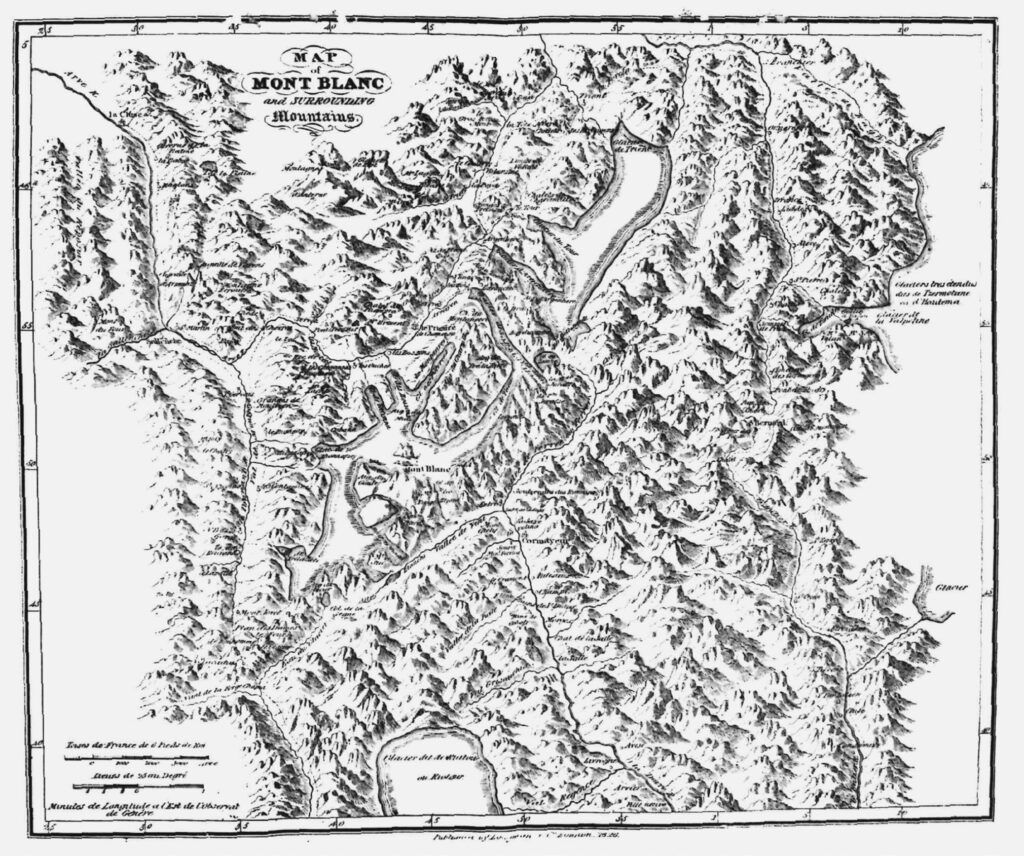
As this case of mistaken identities clearly highlights, local people bestowed quasi-magical names on prominent peaks protruding from mazes of high mountains, despite the fact that in some cases nobody had ever been up there, and these names were not yet affixed to precise topographical locations. With the locations not yet securely identified by names, hazardous cases of mistaken identity could arise. It was not by chance that Mont Perdu—i.e., Monte Perdido—in the Pyrenees became known as a “lost mountain.”12 The syndrome of lost or hidden mountains (also addressed in Escher’s reference to the Finsteraarhorn’s “dark remoteness”) has a characteristic symptom: the molehill style of older maps. By depicting mountainous landscapes in a perspective view from a diagonal angle, they created panoramas that hid what was directly behind mountains from view (Illustration 2). This problem of perspective made it enormously difficult for travelers to orient themselves. This explains the switch from molehill maps to maps providing a complete bird’s eye view—to maps, in other words, that depict terrain as a satellite or the eye of God might see it—that took place so enormously rapidly and so curiously quietly in or around the year 1800.13 This shift not only represented a giant leap forward on the path toward objective knowledge; it was also a symptom of efforts to surmount the illusions created by the perspective of molehill maps. The successes of early Alpinism can be seen as sporting successes—as athletic achievements—but they should not be reduced to this (often unsatisfactorily narrow) perspective. They can and must also be regarded as intellectual achievements, as part of a struggle to gain an overview of previously unconnected knowledge.
2.2 Monte Rosa: A Dearth of Names
It is just such an aha moment (as we say today)—when bits of what was known before suddenly became connected in consciousness—that is preserved in the name of a striking feature in the Monte Rosa group (slightly to the west of the Lysjoch) that is still known today as Entdeckungsfels, the “rock of discovery.”14 In the summer of 1780, the mining entrepreneur Nicolas Vincent from Gressoney Valley in North Piedmont climbed to this point for the third time, having already reached it twice before with a group of chamois hunters (in 1778 and 1779). On both occasions, they had seen a glowing green valley to the northwest, behind massive glaciers, and identified it as the fabled Hohenlauben, which, as the legend had it, had been buried under glaciers to punish the wickedness of the shepherds.15 On their third visit to this lofty location with its impressive views, however, the daring mountaineers were struck by the idea—or they looked down from their high vantage point and discovered—that they were not looking at a mythical valley, but at the real Matter valley.16
This scene at the so-called “Rock of Discovery” has already brought me into the thick of my second story, which is about the discovery of the highest peaks in the Monte Rosa massif in the early 1820s. Ludwig von Welden, an officer from Württemberg in Austrian imperial service who had wound up in occupied upper Italy, took it upon himself (or was instructed) to link the network of triangulation points that French engineers had created from the Atlantic to the Savoy with the Adriatic network created by Austrian military surveyors that now extended as far as Sesia in Piedmont. The peaks of the Monte Rosa massif struck him as an eminently suitable target for advancing this endeavor.
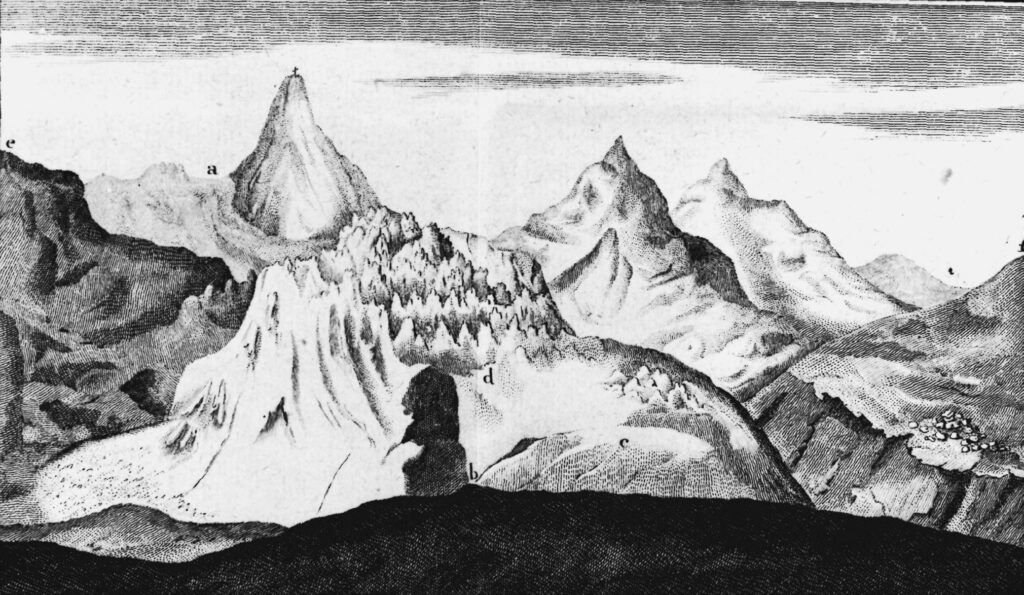
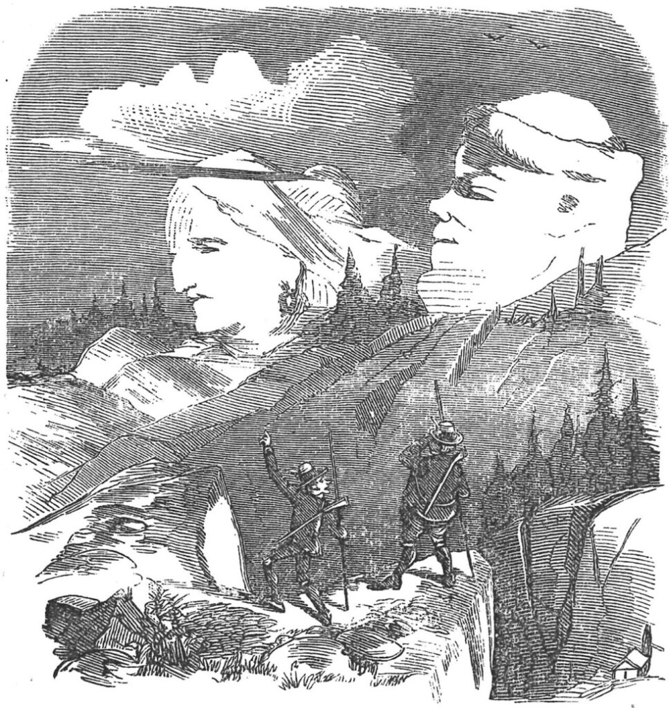
In order to take measurements and make the connections needed to gain an objective overview of the mountains, von Welden naturally required clearly identifiable points, normally peaks—points, that is to say, that could be and had been named. In this respect, however, he had every reason to lament: “On my first journey to Monte Rosa in 1821, I already had the greatest difficulties orientating myself.” He perceived rightly that the problem lay in the “lack of proper names” that “such a large mountain range needs to be described.” Every major peak he asked for the name of on a circular tour lasting several hours was “Monte Rosa,” he continues, claiming that he “could get nothing else out of my guides.”17 When he asked people north of the massif for the name of the highest peak visible from the Matter Valley in the Valais, the answer he got was “Monte Rosa.” When he asked in the south, in the Piedmontese Valsesia or in Valle Anzasca, about the highest peak visible from there, he was given the same answer. “And yet,” as he noted in despair, “it was a completely different” peak, “maybe three or four hours from the previous one”: 18 “The entire massif stretching two hours from south to north and four hours from east to west was called Monte Rosa, and Mont Cervin was the first new name that appeared in this direction.”19 To come back to the wisdom of the goatherd Peter, the tall icy domes of Monte Rosa had “no names” (Illustration 3).
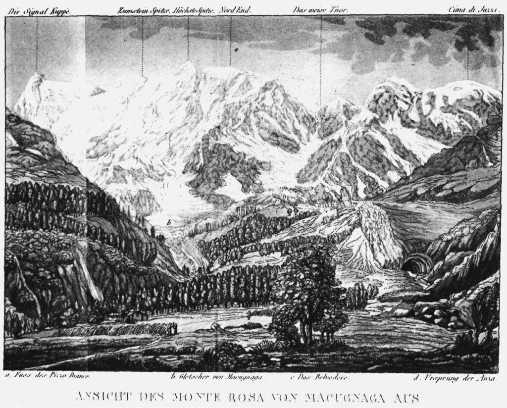
To bemoan a “dearth of names” 20 was one thing. To resolve the problem by assigning names to the most prominent peaks in this extensive zone of high Alpine terrain was quite another. This was what von Welden accomplished, and names he invented and supplied reasoning for—Nordend, Zumsteinspitze, Signalkuppe, Parrotspitze, Ludwigshöhe, Vincentpyramide—have remained in use until the present day and can be found on maps in both Italian and German21 (Illustration 4).
At the very least, this story suggests two important insights:
One is that naming requirements clearly had a cultural dimension that differed depending on the groups people belonged to. The names needed by local people in the mountains were typically connected to their economic interests—their desire to survive and eke out a living—and that explains, for instance, why the ibex and chamois hunters knew and used names that were different from those used by the shepherds. For the same reason, the areas covered by ice and snow year round remained unnamed or, as Colonel von Welden lamented, named only in the vaguest terms.22 If the French anthropologist Marc Augé had not chosen to apply the term “non-places” to other phenomena of our times, it would have been a wonderful descriptor for the highest zones in the Alps before the advent of Alpinism.23
The second insight related to the namelessness of Monte Rosa’s peaks and the ensuing naming campaign is that von Welden’s report plainly highlights the extent to which assigning names is a cultural gesture of dominion: names mark the end of the wilderness. “To equip the world with names means to divide up and classify the undivided, to make the intangible tangible, though not yet comprehensible.”24 Recognizing (and explaining!) this early on, in good time before Alpinism took off, was the merit of such German intellectuals as Johann Gottfried Herder or Friedrich Schiller.25 Naming things makes them usable. It marks them. It highlights them and makes them visible, so conspicuously so that Friedrich Nietzsche could muse on whether as-yet unnamed things can be seen at all: “As people are usually constituted, it is the name that first makes a thing generally visible to them.”26 This can only hold true, of course, when names are unambiguously linked to particular entities—and when multiple entities (such as mountains) are not designated with one and the same name. This problem of surplus or repetitive names was likewise not infrequent in early Alpinism—alongside the problem of a dearth of names—and it could throw up severe and even fatal hazards for orientation. The problem can be illustrated vividly—as a sequel to the stories of Mont Perdu and Monte Rosa—in a third vignette. The incident I have in mind took place during an 1841 expedition to the Jungfrau.
2.3 A Chaos of Names—Too Many Names for “the Jungfrau” in 1841
A group of international researchers directed by Louis Agassiz, then a professor at the Academy of Neuchâtel, had been carrying out meteorological, glaciological, and geological studies on the Unteraar glacier for weeks in the summer of 1841 when they hatched a plan to ascend the rest of the way to the Jungfrau summit. The group of twelve men (six researchers and six guides, some from Grindelwald and others from the Valais) stocked up on provisions at the Grimselhospiz guesthouse and set off. Their route took them up to the Oberaar glacier and through the cols known today as Oberaarjoch and Grünhornlücke before they descended to a point on the glacier that they called Ruheplatz, “resting place”; today it is known as Konkordiaplatz. Only once they had progressed this far did the question arise as to which of the icy peaks was actually Jungfrau! According to a report by an expedition participant, the geology professor Eduard Desor:
A lively dispute over which summit was the Jungfrau broke out among the guides. The Valasian […] pointed to a summit on our right, claiming that it was at least the peak known as ‘Fraueli-Horn’ (the Valasian name for the Jungfrau); the other guides, especially Jakob [Leuthold] wanted to identify the highest summit on our left as the Jungfrau. They all put their own opinions forward vehemently. But when I was leaning toward the Valasian’s viewpoint, Jakob went into a rage, threw his load down onto the ground, and declared himself insulted at his knowledge of the mountains being doubted. He knew the Jungfrau even if he had not been up there, and he would leave us on the spot if we started climbing toward the poor summit proposed by the Valasian. We finally decided to follow our old Jakob27 wherever he would lead us, as Agassiz suggested, and soon we saw that he was indeed correct and that the peak shown to us by the Valasian as the Frauelihorn was only a lower peak south of Mönch belonging to the Grünhorn massif. We gave it the name Trugberg [“deceptive mountain”], because of the confusion it had caused. But that Jakob knew the Jungfrau is proven by the flag fluttering on its summit.28 (Illustration 5).
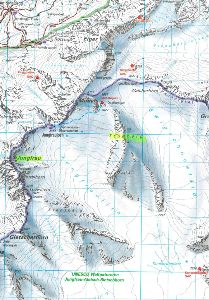
The disparaging name “Trugberg” has stuck to this day and taken its place on maps. It is a remarkable stone monument to the once so fluid and now petrified history of mountain names, and an illustration that name-giving always depends, among other factors, on power29: the almost childish scene the guide Jakob Leuthold made—throwing down his pack, stamping his foot, and issuing verbal threats—hints at old animosities between residents of the Hasli Valley and the Upper Valais (as well as Jakob’s sheer bossiness) that are now preserved on maps for all time. It could have been acknowledged at the time that the issue was scarcely one of knowing or not knowing, of being competent or incompetent, but plainly a cultural misunderstanding: the inhabitants north and south of the Jungfrau area simply used the word Jungfrau to describe different peaks. Such practices created inevitable problems—a culturally determined “Alpine hazard”—when mountain travelers appeared on the scene with their pressing desire for unambiguous route descriptions.30
3 A Surfeit of Names
3.1 Local Reason
The example narrated by our reporter, Eduard Desor, shows how difficult it was for mountain travelers to cope with this problem.31 Desor, too, participated in the ethnocentric game of “right” and “wrong” names even though he knew full well that people in different valleys used different names for one and the same mountain: “Practically every valley,” he acknowledged, “gives different names to the mountains visible from that valley. The Schreckhorn is called Lauter-Aarhorn in Hasle; even the Finsteraarhorn is known as Schwarzhorn in Upper Valais.”32
The “dearth of names” that was the subject of so much and such verbose lamentation was thus complemented, rather paradoxically, by a surfeit of names that had already been described almost half a century earlier (on the occasion of a journey on foot through the Bernese Oberland) by Georg Wilhelm Friedrich Hegel, at that point still an unsung private tutor in Bern who would go on to become a famous philosopher. Hegel noted
that every valley gives names that are also found in other valleys to the surrounding mountains. There is thus a Lauterbronn Wetterhorn, a Schreckhorn, a Lauterbronn Jungfrau and Scheidegg; names that the Grindelwalders also give to certain mountains in their valley. […] If one has heard certain mountains that can be seen from Bern called by these names, and one asks about these same names in the valleys, one is shown a different mountain called by this name in every valley.33
Hegel thus refers, entirely logically, to a view of “one face of that Jungfrau which is called thus in Bern.”34
The problem to which Alpinist authors pointed to as “utter confusion” in the “nomenclature”35 and “bewildering”36 was, of course, both as widespread37 as it was long-standing by this point. As far back as 1485, an official charged with establishing the course of the border between the Allgäu and the Tyrolean part of the Lech Valley had complained that he could not determine the names of the mountains, “presumably because the farmers at one end seem to call them something different than those at the other.”38 Diligent comparisons of panorama drawings of the Bernese Oberland have shown that four names each were in use for Eiger and Jungfrau (and a whopping seven for Mönch!) in the decade and a half between 1775 and 1790 alone;39 original drawings in which the names of peaks have been “crossed out and rewritten, or replaced with entirely different ones” again and again bear ample testament to the difficulties that illustrators of mountain panoramas faced. One nineteenth-century scholar noted that: “Some points bear two or three names alongside and on top of each other.”40
None of this seems to have caused any major problems for the inhabitants of the Alps while the exchange of people, goods, and ideas continued along well-established routes. Eighteenth-century intellectuals—Enlightenment philosophers like Georg Christoph Lichtenberg or Justus Möser—anticipated subsequent developments and elaborated the concepts of local philosophy or local reason to explain the old state of affairs. They believed that provincial or local cultural ensembles could have their own coherent systems of logic and reason that ought not to be willfully vandalized by newfangled thinking (as Möser put it). Lichtenberg saw superstition as a kind of Lokal-Philosophie that could be quite logical within a specific cultural context.41 Möser considered examples from farming:
The forest might have to be protected in one place, while in another trees can be felled. Letting animals range in the forest might be destructive in one location but necessary for higher reasons elsewhere. Pigs might need to be herded, fenced in, or housed in some places, but could be turned out to range freely in others. Who could make a general ordinance for a forest or a district with general permissions and prohibitions without harming private property and the true purpose of every forest or of all a district’s inhabitants?42
Möser pointed out, in defense of local reason, that it was “a general complaint of the current century” (the eighteenth) “that too many general ordinances” were issued and “too many things forced under one rule” in a fashion that stripped away the richness of nature (or, as we would phrase it today, of culture!).43
The plurality of names that had emerged under the conditions of local reason could not continue to be experienced as a form of cultural wealth in the new “age of comparison” (as Friedrich Nietzsche called the modern era at the end of the nineteenth century)44: they inevitably struck the mountain travelers and Alpinists of the new era as frustratingly confusing and dangerously chaotic—the results of the old local reason had become unreasonable in the context of the new era and its strivings.
3.2 Flitting Will’ o the Wisps
There were other reasons, too, for the unruly muddle of mountain names, although their influence may have been less significant. I will mention only three of these trends that flitted about like will o’ the wisps here, and I will treat all three with the necessary brevity: the historical game of intellectual fashions, irony, and simple linguistic misunderstandings.
A substantial number of the mountain names that are familiar to us today probably resulted from simple misunderstandings—misheard or mistranscribed, mistakes that went unnoticed at the time. The fact that the surveyors (whose work supplied the basis for the earliest precise maps, complete with their inventories of names) had to be admonished time and again to take care when noting down names hints at the extent to which such errors arose.45 The issue was complicated further by the prevalence of dialects and according variances in pronunciations,46 and the widespread skepticism of locals about surveying projects can hardly have helped surveyors to register names more accurately.47 Even without such special circumstances to potentially complicate the situation, however, the risk of corruption—of misunderstandings that distorted names48—was considerable. The practically grotesque situation of the notable (but also quite deaf) surveyor Peter Anich from Perfuß near Innsbruck can be taken as an apt symbol for the situation of every surveyor and recorder of names. The unfortunate Anich lost his hearing quite early on, “and finally became so deaf that one had to shout every word slowly and clearly, directly into his ears, if one wanted him to understand.” Furthermore, a contemporary reported:
His deafness caused him more than a little trouble (as can easily be deduced) in his geometric work, especially because of the many names of the places he measured and the rivers and districts he described. He had to research all these special words by asking the inhabitants repeated and persistent questions they could only answer with loud shouts, and he often understood the answers poorly.49
This organic hearing loss is only a particularly drastic example of what we might call the “cultural deafness” of the mountain name inventory takers. And they may have been particularly confused when misunderstandings were played with systematically, as it were (if this apparent contradiction can be tolerated momentarily). When we think about it, irony is, in fact, just such a systematic game which plays with misunderstandings: one says something—and means quite the opposite. The principle of ironic naming has long been acknowledged by research into place names,50 and early mountain travelers (in the final decades of the eighteenth century) encountered it, too. David Herrliberger commented that the Rheinwald valley in Grisons was a “dreadful wilderness and a horror-filled place where one could freeze to death in the hottest summer. But it is called Paradise,” he registered with astonishment, attributing the name to an “inverted way of speaking.”51 Sigismund von Hohenwart was annoyed by the “ridiculous” name of “garden” for a spot in the Alps around Reichenau an der Rax because he could hardly conceive of “a lonelier and more horrible spot” than “this wilderness.”52
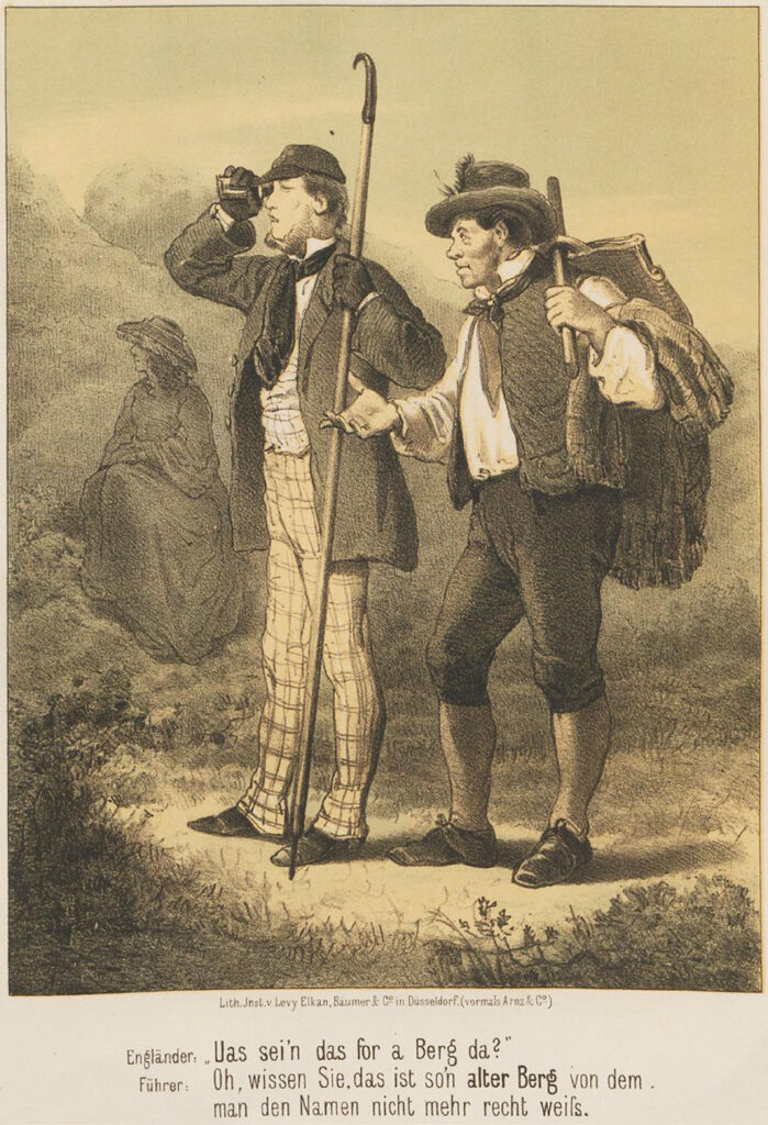
These were admittedly examples of detectable irony—of what we might call “regulated irony.” It is, however, likely that there are many more cases to which we remain oblivious in retrospect. Hundreds of names that have found their way onto maps and into guide books describing Alpine tours must have resulted from the desire of local guides to satisfy the hunger of mountain travelers and Alpinists for names (“What is that peak up there called?”) and, at the same time, to put one over on them in a field where the competence of locals was beyond doubt. Mountain travelers—and we modern historians—were left with only inklings that mischievous inventions of names on the part of the locals must have played a prominent role. Some early Alpinists clearly suspected at times that a “clash of cultures” with a clandestine dimension was underway in the middle of Europe. Anton von Ruthner distrusted the name Herzogshut [“duke’s hat”], for example, musing that “one or another flamboyant discoverer of similarities” must have come up with it.53 Friedrich Simony believed that some names “justified” the suspicion “that here, as so often, a son of the Alps who did not treat the naming of peaks scrupulously” had “improvised” a name that would be better extinguished; it was known, after all, “that the most seasoned guides were also the most inventive christeners of mountains.”54 Carl Gsaller, too, registered the significant role played by “rogues and jokers” who served “lies” up to urbanites curious to discover what mountains were called.55 (Illustration 6)
The locals in the Alps were not the only ones who played with the names of mountains; citizens beguiled by the thrilling early nineteenth-century fashion for Alpinism engaged in such games, too. Early on, complaints arose that “strangers” (as we hear from Switzerland) had “taken the liberty of giving mountains names in their texts” that differed from the established names, “which could eventually lead to a muddle.”56 The imposing ridge above the northern Monte Rosa glaciers overlooking the Rhône valley was once simply called—like everything else in the neighborhood, as von Welden had already complained!—“Monte Rosa.” It was christened Silberbart [“silver beard”] later on and finally received the name by which it is known today and designated on maps: Lyskamm57—and absolutely nobody can say how it came to be thus. Attentive contemporary observers did note some suspicions from which we can glean insights into the mysterious workings of the naming scene. In 1806, Escher described his puzzlement over the unexplained question of how Jungfrau had gotten its name: “The current name of this Jungfrau [”virgin“] with a heart of stone does not seem to have been known to our rugged forefathers, although they could hardly have missed this imposing edifice.” Instead, the mountain had been known as Großhorn [lit., “grand peak”]—“a typical name,” Escher commented, “that nobody wants to hear much about now.” He mused that the “more chivalrous new world” must have given the old Großhorn “the poetic name of Jungfrau” and, to top it all, gone on to “plant” Mönch [“the monk”] next to her “as a triumphant and dangerous neighbor” where previously the “inner Eiger” had stood. Escher also mentions the example of Mont Blanc in the western Alps and its “promotion from a cursed mountain [Mont Maudit], as the locals had called it, to a white mountain.”58 We can also recall another prominent example from the eastern Alps: the romantic and mysterious name Venediger [Venetian] seems to have displaced the older and more practical-prosaic name Sulzbacher with ease, again in the late eighteenth century.59 Escher, a watchful observer of the latest trends in the Alps, noted in 1806 that the “muddling and confusion of names” was “getting out of hand” and specifically added that people were “playing with it”; “the names of the mountains and their celebrity” had to “tolerate revolutions,” as Escher put it, mainly because “the sweeter world of the present time generously bestows nicer names on things.”60 It is a testament to Escher’s astonishing clear-sightedness that his cultural diagnosis of the history of mountain names could still be confirmed in the mid-twentieth century with reference to tendencies both “to exaggerate splendor”61 and to evoke the sentimental-folkloristic ambiance of “the glow of the Alps and the poetry of Alpine roses” to borrow a phrase from Gottfried Keller.62
4 The Mountain Names Are (and Become) Established
Alas, this entire wild history of lacking and superfluous mountain names was soon no longer of interest to anybody: people recalled neither the fashionable jesting that seemed so arbitrary (but was driven by powerful undercurrents of the times) nor the “revolution” of names to which Escher had drawn attention. In 1885, a young doctor of medicine, Emil Zsigmondy, published a handbook on the hazards of the Alps that became a near-instant classic. Although it dealt with rock falls and slippery grassy slopes, avalanches and treacherous cornices, glacier crevasses, weather conditions that could change in the blink of an eye, darkness that could descend suddenly at night, and the dangers of overconfidence in mountaineers, there is no mention of the challenges names presented for earlier Alpinists. That missing or confusing mountain names had ever complicated or even precluded proper orientation, and that the originally chaotic “nomenclature” (as Alpine historians soon called it) had initially been among the greatest “hazards of the Alps”—that had already been entirely forgotten by 1885.63 Otherwise thoughtful and renowned nineteenth-century historians of Alpinism, such as Ludwig Purtscheller or Eugen Guido Lammer, did not acknowledge that the confusing profusion of names had been a source of fatal danger within a generation or two before they were writing64—and that clarifying and resolving these problems consequently ought to be seen as one of the most significant contributions to the original aims and purposes of the Alpenverein [Alpine Club] and specifically to its goal of making “traveling” in the Alps “easier.”65
That such a considerable portion of the history of Alpinism was simply “forgotten” can surely also be seen as an indicator that this chaotic naming phase was regarded as something of an embarrassment. A second indicator for an evidently insatiable urge to impose instrumental rationality66 on the landscape of the Alps can be seen in the curious belief that the motley muddle of names that had ultimately arisen in quite a disordered fashion could be ordered following the all-too-simple principle that names were either “correct” or “wrong”67—although it ought to have been plain for all to see that chance had played a huge role and that opportunities to influence the literature had been unevenly distributed, with those who could not write and publish in Alpine media having little hope of launching new names. Carl Gsaller from Innsbruck was able to boast that he had proposed two hundred “correct” names within the space of a few years in one limited area alone (in the areas around Karwendel, Stubai, and Mieming),68 and he developed a method of his own for such “rectifications,” as he called them.69 It expressly included a strategy to ensure that proposed “rectified” or “correct” names would find acceptance. Gsaller called this the principle of “literature names”70—and what he meant by this was simply that new names mentioned in descriptions of an Alpine area subsequently spread as if of their own accord “with the help of streams of tourists” and soon also entered the “common parlance” of locals.71 Gsaller, whose style is otherwise very dry, underscored his point with a lively description of a rather revealing scene: During their surveying work in the Stubai Alps in 1863, the Alpinists and scientists Ludwig Barth (von Barthenau) and Leopold Pfaundler (von Hadermur) had climbed a snowy ridge that the locals knew by only one name, Wilder Pfaff [“wild parson”]. But now, we read, “as they sat on the narrow icy ridge, a need for specialization arose, and they named the lofty seat they had taken Pfaffenschneide [‘parson’s blade’], the culmination point of the [previous] Wilder Pfaff became Zuckerhütl [‘little sugarloaf’], and the last ice block on the east of the ridge became Oestlicher Pfaff [‘eastern parson’].”72 These names, Gsaller reports with pleasure at seeing his method of establishing nomenclature confirmed, “went from mouth to mouth in Stubai until most people believed they had always spoken thus.”73
This is one pithy takeaway from the story of how the name Zuckerhütl was invented in 1863 out of the clear blue sky. The other illuminating aspect of the story is that the two inventors of the name reported that they had invariably heeded the naming expertise of their “best guides, especially the chamois hunters.”74 In this case, that was certainly not what had happened, but their inventions exuded the comforting “Alpine roses” mood that is seemingly so irresistible to us all, thus practically guaranteeing their success.
The act of giving names is, as we know, accompanied by a thrill of clandestine pleasure. This pleasure shimmers revealingly through many accounts of the act of name-giving—and becomes all the more visible when it attempts to hide behind a semi-troubled conscience. The pioneering Alpine explorer and monk Placidus Spescha, writing in 1812, noted that he had, because he was “so unfamiliar with the names of the mountains,” been compelled to furnish “the same with an invented name” and that his “lack of knowledge” had made it necessary for him to “christen the highest mountains.”75 More often, admittedly, the paradisaical pleasure of giving names and lording over nature (with the “borrowed” authority visible in the biblical story of creation) was indulged exultantly—and with elaborate ceremony, too, where aristocratic-baroque manners still held sway, as during the first ascent of the Großglockner in 1800: the Apostolic Field Vicar Sigismund von Hohenwart, who had initiated and organized the entire enterprise, gave a speech in front of the new hut below the Glockner, just ahead of the glacier, in which he called on the expedition’s financial backer, Count Franz Xaver of Salm, the prince-bishop of Gurk, to propose a name for the hut and the surrounding area. Salm, who is described as having been “uncommonly merry,”76 came up with the name Hohenwarte [lit., “high observatory”] and had liberal quantities of Tokaji wine served to the party—wine that “peasants” from the parish of Heiligenblut had carried up the mountain in barrels with great effort.77
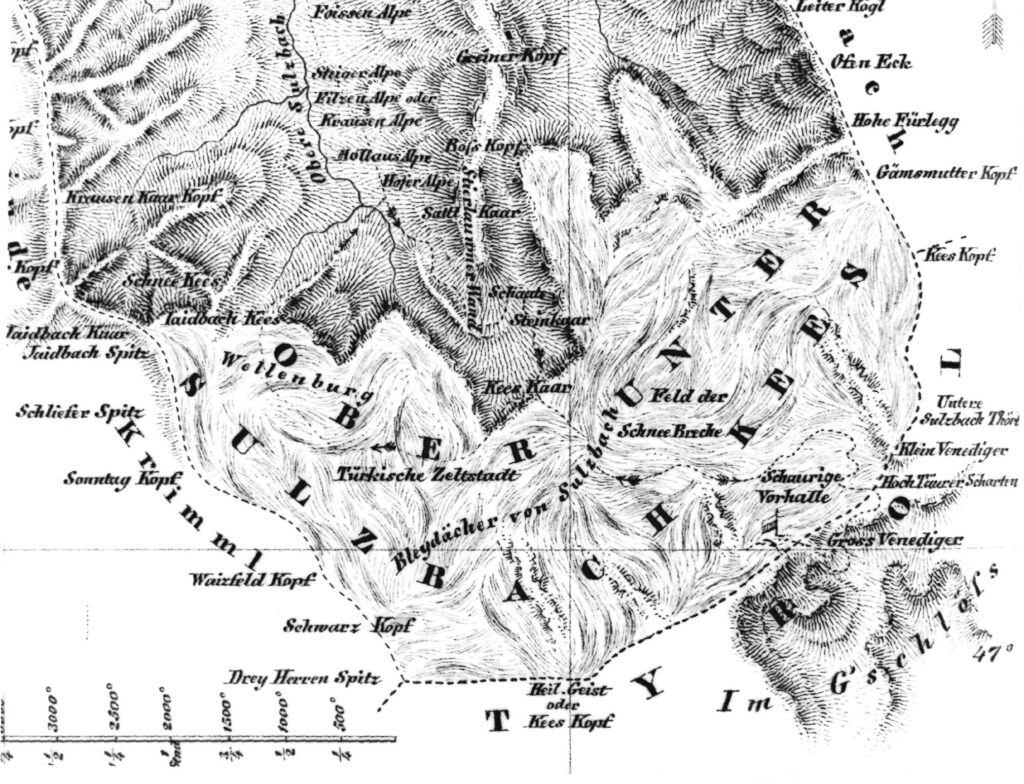
Other naming initiatives will not have been celebrated with quite the same degree of ceremony, but the sense of pleasure felt by sons of Adam with less exalted status is also impossible to overlook. The names Warte [“look-out point”] and Freudenhöhe [“joyous height”] that the theology student Valentin Stanič bestowed upon points on the mountain Hoher Göll documented the pleasure he felt at reaching both points.78 Colonel Ludwig von Welden’s Monte Rosa survey yielded the names Signalkuppe [“signal dome”] and Zumsteinspitze [“at the stony peak”], Nordend [“north end”] and Vincentpyramide [“Vincent’s pyramid”], Schwarzhorn [“black mountain”] and Parrotspitze [“parrot peak”] and finally even Ludwigshöhe [“Ludwig’s summit”], named for von Welden himself.79 The well-read mountaineers who made the first ascent of Großvenediger must also have been pleased by their name choices (Schaurige Vorhalle [“spooky antechamber”], Bleidächer von Sulzbach [“lead roofs of Sulzbach”] and Türkische Zeltstadt [“Turkish encampment”]), which were clearly inspired by Romanticism80 (Illustration 7). The person who first visited or climbed a mountain was generally seen as entitled to choose a name for it—or, to put it more accurately, naming rights were seen as the prerogative of those who discovered gaps on the map in need of names.81
Nobody will be surprised to hear that this old right of Adam was sometimes constrained by bureaucratic corsets—as, for example, when the name of the Simony peaks (in the Venediger group) was chosen at a meeting of the Austrian Alpine Club in 1865 or when the name Dufourspitze [“Dufour peak”] was chosen to replace von Welden’s Höchste Spitze [“highest peak”] on Monte Rosa in 1863 by no less an institution than the Swiss Federal Council.82 Legal niceties aside, the names that mattered in the end were always the names printed on maps.83 Maps bear witness to the names that were established—in the double sense of being discovered and of becoming established and being perceived as definitive, sanctioned, and unchangeable (Illustration 8). The name “Trugberg” on the map of the Jungfrau area is a remarkable (albeit hardly remarked upon) monument to the process of rectifying, establishing, standardizing, and canonizing mountain names. It is also a reminder that countless hundreds of other “deceitful mountains” bore names that were extinguished to create a uniform nomenclature—in a process that undeniably bore imperialist traits.84 This brings Möser’s lament from the final decades of the eighteenth century to mind and his point that enforcing a single uniform rule on everything would rob local culture of its “wealth.”85
5 Celebrating Names
When we speak of sanctioned (and essentially: sanctified) names—of a canon of names, a names dogma, and even, as is conventional, of christenings—we know (and we can feel) that we are moving in an exalted cultural sphere, in a space marked by ceremony and a rarefied cultural ambiance that is actually rather surprising. Initially it may have seemed that the world of mountain names was smoothed out for purely rational reasons, especially to satisfy the need for secure navigation on mountain routes. But on closer inspection, it transpires that mastering the new world of names demands a courageous look into depths of the soul—a somewhat unexpected imperative. I would like to demonstrate this briefly—all too briefly! —with reference to three issues: a change in how views were perceived, the gesture of pointing, and the transformation of mountains into mountain faces.
To imagine that past travelers experienced views as we experience them today—with a feeling of panoramic expansiveness and a sensation that the world is lying at our feet—would be to deceive ourselves. “Views” seem to have become one of our highest cultural values in these complex and changing times (as evidenced by modern-day holiday apartment brochures!), as gaining an overview has become progressively more difficult. The accounts of the mountain travelers of the late eighteenth and early nineteenth centuries allow us to recognize that they were not only surprised to find that the views from above could reward them for the difficulties of ascents, but that they also knew or at least had some inkling that this had not always been thus. Looking down into the depths and into the far distance (when people dared to do it at all) had been characterized (and mostly: prevented) for thousands of years by fear of the bottomless void, horror, and a bad conscience—it was regarded as an impudent appropriation of the perspective of God. Looking into the distance had to be learned, with difficulty,86 and this emancipation process eventually led to preliminary investigations into the psychology of views undertaken by, for example, Hans Conrad Escher, who wrote in 1808:
What is it that drives some people to the breakneck endeavor of climbing to heights that do not seem to be made for their element and that offer the tired traveler nothing more to savor than a chance to look down on their fellow human beings for a moment and to domineer over a wide area! There must be something magical in this looking down, in this dominion wielded from above!87
The experience of wresting pleasure from views is thus a cultural achievement of modern times, but another experience followed hot on its heels: recognition that this pleasure could be boosted by knowledge, specifically knowledge of mountain names—or, to look at this the other way around, recognition that the pleasure to be had from views was much reduced when one could not recognize the mountains by name. Reports of ascents in the eastern Alps from the mid-nineteenth century are full of laments about the lack of interest and knowledge shown by guides in relation to names88 (in complete contrast to Swiss guides!): “As a result,” Anton Ruthner complained about his view from Similaun in 1842, “I lost more than half the pleasure of this view”[!].89
Tourists were mocked from quite early on for their interest in names (on Mount Rigi, for example) and described as recipients of “a list of the names of all the mountains in front of them that they use to while away time and satisfy an idle kind of curiosity” even though “every nomenclature” only weighed down “one’s memory with superfluous verbiage.”90 Nevertheless, an entire literary genre emerged around this time that assuredly does not belong among the pinnacles of German prose: seemingly unending and scrupulously precise descriptions of views from particular points were prepared that named all the mountains visible from each point and went on for many pages. In 1840, Peter Karl Thurwieser spent almost eight hours on Ahornspitze in the Zillertal Alps writing down names for his panorama. The resulting description stretches over almost six pages in print,91 and Anton von Ruthner’s literary panoramas describing the likes of the Wildspitze or Wiesbachhorn each take up seven printed pages.92 These texts were the product of disciplined, methodical work with maps and binoculars. Ruthner sharply criticized an alternative “sanguine” (i.e., more hot-blooded) approach driven by “an excited mood”93—the author’s enjoyment and his reward ought, he believed, to come from the satisfaction of matching names and silhouettes and thereby making them accessible to the world, since they were now identified and could be pointed out.
The old gesture of pointing with an outstretched arm and outstretched hand, and perhaps also an outstretched index finger, took on an entirely new meaning once a canon of “established” names existed. Anthropologists long attributed a significant place in the cultural development of humanity to this pointing gesture.94 With this development, however, the openness of gazing into the distance and receiving challenging and stimulating input was suddenly channeled into a narrow and mundane equivalence between a mountain pointed out and a name heard: “And that one up there is the ‘Watzmann.’” Numerous depictions of this pointing gesture—especially in prestigious locations—remind us of its new but nevertheless also quasi-iconic status (Illustration 9).
Another picture genre inspired by the “established” canon of names also took off and enjoyed success: the mountain faces that were so enormously popular—especially as postcards—from the 1890s onward. It was inevitable that depictions would be produced that took mountain names literally and showed Jungfrau as a virgin and Mönch as a monk, and such images duly circulated from 1870 onward, at the latest.95 Emil Hansen, the artist who subsequently called himself Emil Nolde, gave this trend enormous impetus96—it has survived, at any rate, until the present day. One can disagree on whether these images merit criticism as shallow bourgeois representations of the sublime (the “majesty of the mountains”97) or praise as ironic commentary on the sanctity awarded to the mountain nomenclature 98 (Illustration 10).
6 Shaking the Dogma
In this latter view, the mountain faces could be seen as part of an entire series of mostly recent, or indeed current, attempts to unseat the dogma of the “rectified nomenclature”—and I would like to mention these attempts briefly in conclusion because they shed light on the stability of a cosmos of mountain names that has largely existed only since the nineteenth century.
It is impossible to overlook the attempts to correct names based on modern political ideologies and critical reappraisals of history. Mountain huts have been renamed (the Wolayersee Refuge in the Carnic Alps, for instance, which was previously known for eighty years as Eduard-Pichl-Hütte99) and so have routes (Cyprian Granbichler Weg instead of Titzenthaler Weg100). The “Démonter Louis Agassiz” campaign striving to have the Agassizhorn in the Bernese Alps renamed (because Agassiz, the Swiss glacial science researcher, was also a proponent of scientific racism), has thus far not achieved its objective. It is, in any case, somewhat doubtful that simply extinguishing a name from memory is productive (even a name that has become offensive!)—and drastic language (“history exorcism” or “history as a feelgood zone”) has recently been used to draw attention to this problem.101
Bestowing names has always been a gesture of dominion. Names chosen for political purposes made this especially obvious—and in the hothouse of late capitalism, the nexus between names and power is also too conspicuous to overlook. The planned sale of two peaks in East Tyrol in 2011 (Große Kinigat and Rosskopf) by the Austrian Federal Real Estate Institute (Bundesimmobiliengesellschaft, BIG) attracted considerable attention—especially as rumors quickly grew that the mountains would be given new names by their purchasers for advertising purposes.102 The sale and renaming of these mountains did not go ahead in the form originally planned (not least, presumably, because of the protests and the objections raised in political committees), but efforts to block the village of Prägraten from selling another mountain, the Mullwitzkogel103 in the Venediger area, were unsuccessful, and the village authorities resolved to rename the mountain Wiesbauerspitze after its purchaser, the sausage maker Wiesbauer, in 2007.104 Such developments should not engender any surprise;105 the advertising sections in mountaineering and hiking journals have been filled with creative deployments of mountains as ideal advertising spaces from their very beginnings106 (Illustration 11).
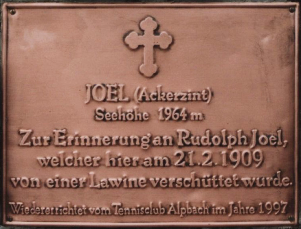
A third source of motivation to alter names also deserves a brief mention and may rear its head more often in the future. It could be seen—rather disparagingly—as tinged with the rosy glow of Gottfried Keller’s rosy cliffs and Alpine roses, but we ethnologists would call it a folkloristic trend—a conscious resurrection and re-adoption of local or regional cultural traditions that have been submerged for some time. A grassy mountain in the Kitzbühel Alps had acquired some significance in the early phase of ski tourism in Alpbach Valley. After the Munich student Rudolph Joel was buried by an avalanche and lost his life there in February 1909, a stone cairn was erected locally in memory of the tragic accident. This must had led to the name “Joel” subsequently being applied to the mountain as a whole and eventually also making its way onto maps. When a commemorative bronze plaque was affixed to the restored monument two years ago, however, a second name appeared alongside that of Joel—Ackerzint—which seems to have re-emerged from local memory.107 If the tour reports I see on the Internet are indeed an accurate reflection of usage, this old/new name is now gaining ground and becoming increasingly popular (Illustration 12).
Such observations and the stories gathered here suggest to me that the tangled history of how mountain names became established could be an additional key to understanding the processes underlying the opening up of the Alps—not least because rational and irrational elements are so closely intertwined and the characteristics of purposeful and instrumentally rational action are covered in a patina of sepia or even obscured by dark shadows of fairy-tale proportions. While people are prone to dismiss names as mere sound and smoke, as devoid of deeper meaning, the cultural history of our mountain names shows us that quite the opposite is true.